Showing posts with label cities. Show all posts

27 January 2016

invisible cities, illustrated.

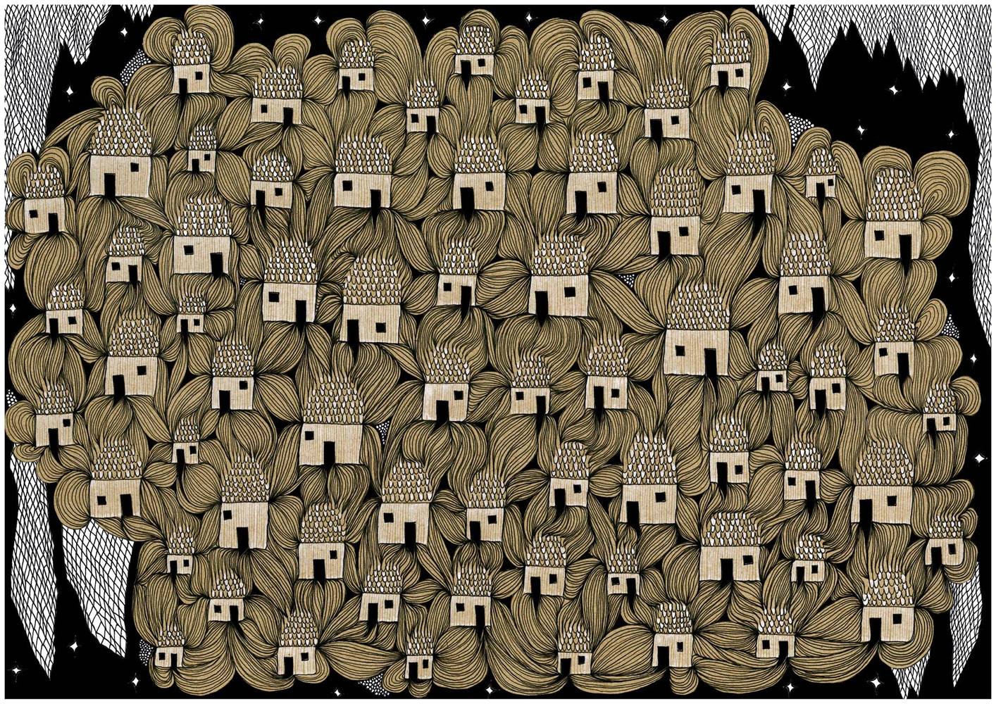
Lima-based architect Karina Puente has a personal project: to illustrate each and every "invisible" city from Italo Calvino's 1972 novel. The book, which imagines imaginary conversations between the (real-life) Venetian explorer Marco Polo and the aged Mongol ruler Kublai Khan has been instrumental in framing approaches to urban discourse and the form of the city. (via)

08 August 2012

knoxpatch?

check out this feature on knoxville in a little publication called "garden & gun".

my favorite line:
"Almost everyone thinks something should be done, but nobody does anything much."
i would thx rob if he wasn't capable of posting this himself. #lazy

27 February 2012

curbing sprawl in nashville

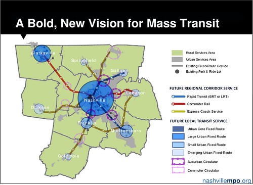
The regional planning authority for the Nashville, Tennessee, metropolitan area has embarked on a new philosophy to put the notoriously sprawling region on a less polluting and less consumptive path, anchored by walkable neighborhoods, public transportation and maximizing the efficiency of current roadways.
Meeting the laudable goal of shaping a more sustainable region will not be easy: in 2001, the Nashville metro area was cited as the nation’s most spread-out – the area with the fewest number of residents per square mile – in a review of 271 of our largest metro areas.
If Nashville’s land use challenge is daunting, its transportation challenges – in large part created by the predominance of sprawl – are similarly formidable. (via)

16 February 2012

nErD aLeRt!


Around the world, only a few hundred people make a living as fulltime typeface designers. Two of them happen to live in Chattanooga, Tennessee, population 167,000, where they've embarked on an ambitious project to distill the city's artistic and entrepreneurial spirit into a font called Chatype. The goal is to help the city and its businesses forge a distinct and cohesive identity through custom typeface, sending a visual message to the world that Chattanooga—a rapidly growing city in the midst of a creative renaissance—is “more than just your average Southern town.”
Chatype came about when D.J. Trischler, a brand consultant, discovered he'd been sitting next to typeface designer Jeremy Dooley at their local coffee shop. The two became fixated on a question: What if Chattanooga had its own typeface? The idea may sound strange from an American perspective, but it's actually the norm throughout Europe, where even small cities employ custom typeface to distinguish themselves. In the United States, the only similar attempt was a failed one by academics in the Twin Cities, according to the Chatype team. Yet Trischler and Dooley say this is the first-ever attempt to create custom typeface at the grassroots level, rather than from the demand of a city government. (via)
what i learned from this video is that people that live in chattanooga are weeeiirrrddd....

04 May 2011

pigeons are idiots.

but that's old news. here's an article correlating the brain sizes of birds and their ability to survive in an urban environment.
Only a handful of species can survive in cities, and the authors speculate that increasing urbanization worldwide may result in a long-term decline in populations of smaller-brained birds.
Except for pigeons.
They are small-brained, said the lead author, Alexei A. Maklakov, an assistant professor of evolutionary biology at Uppsala University. But the urban environment provides them with a close approximation of their natural habitat, so they need little intellectual energy to adapt.
There are plenty of tall buildings that resemble the rocks they normally nest on, and, Dr. Maklakov said, “they don’t have to invent any novel ways of finding food. The food we throw away is fine for them.” (via)
this also marks the third time in a week that uppsala has been mentioned in something i'm reading. first, in the girl who set fire to her wasp tattoo, which i finally just finished. then, in the age of wonder, which i'm currently reading. and now, this. trend alert!!

26 January 2011

china's planning a megacity.

and it scares the pants off of me.
City planners in south China have laid out an ambitious plan to merge together the nine cities that lie around the Pearl River Delta.
The "Turn The Pearl River Delta Into One" scheme will create a 16,000 sq mile urban area that is 26 times larger geographically than Greater London, or twice the size of Wales.
The new mega-city will cover a large part of China's manufacturing heartland, stretching from Guangzhou to Shenzhen and including Foshan, Dongguan, Zhongshan, Zhuhai, Jiangmen, Huizhou and Zhaoqing. Together, they account for nearly a tenth of the Chinese economy.
Over the next six years, around 150 major infrastructure projects will mesh the transport, energy, water and telecommunications networks of the nine cities together, at a cost of some 2 trillion yuan (£190 billion). An express rail line will also connect the hub with nearby Hong Kong. (via)
they say it's population will be around 42 million.

19 November 2010

05 October 2010

san fransisco gets tilt-shifted.


Multimedia designer Shukhrat Pardaev assembled this beautiful tilt-shift video of San Francisco, following in the footsteps of shorts using the same miniaturization technique on New York and Sydney. (via)


(note: i never saw the nyc version, but it is also amazing, and features a lot of construction shots of the brooklyn bridge pier parks)

28 September 2010

drunk-drivin'-est cities.

c2e.

Cities with the most drunk driving offenders
1. San Diego
2. San Jose
3. Charlotte
4. Phoenix
5. Columbus
6. Indianapolis
7. Los Angeles
8. San Francisco
9. Austin
10. Jacksonville
11. San Antonio
12. Dallas
13. Houston
14. Fort Worth
15. Memphis
16. Philadelphia
17. New York
18. Baltimore
19. Chicago
20. Detroit

(via)

26 May 2010

maps.

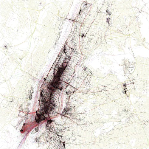
new york.

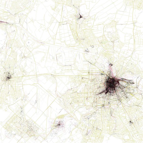
amsterdam.

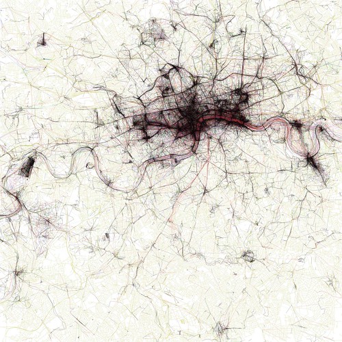
london.

The Geotaggers’ World Atlas.
Flickr wizard Eric Fischer mashes together the online photo management site with geotags, Picasa, OpenStreetMap and a healthy dash of code to show how people take photos in each city, and at what speed they were moving when taking those photos.  (via)
 
Pin It